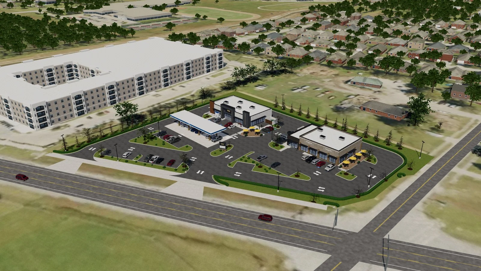
Send us your site plan. Our AI reads the sheet, pulls the public record for the address, and builds your project in 3D in its real neighbourhood. You get one link to share.
What you send: the plan sheetYou sendWhat you get: the site, builtYou get
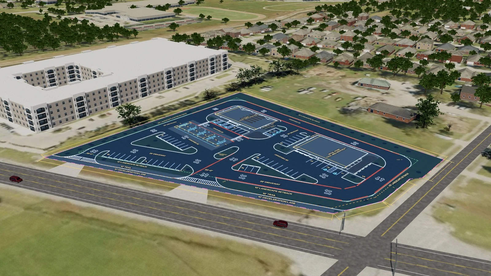
Drag the handle. Same site, same camera: Anchor & Bay, League City, Texas.Concept study, not for construction
plan sheet from the architect went in
1
plan sheet from the architect went in
neighbouring buildings added from public survey data
1,611
neighbouring buildings added from public survey data
trees placed where the survey and the aerial image show them
7,293
trees placed where the survey and the aerial image show them
link came out, open on any phone or laptop
1
link came out, open on any phone or laptop
How it works
You send three things. The AI does four jobs. You get one link.
01 / YOU SEND
Your site plan
The architect’s sheet, as PDF or CAD
Renderings or photos
Only if you have them
A short brief
What it is, and the wording for your signs
02 / THE AI
1
Reads your drawing
Every line, note and table on the sheet becomes paving, kerbs, buildings and parking.
2
Pulls the public record
Aerial imagery, an elevation survey, flood maps, traffic counts and Census data for the address.
3
Builds the site
Your project from your drawings. The streets, houses and trees around it from the survey.
4
Tells you what does not match
Where the sheet, your brief and the public record disagree, listed for you to settle.
03 / YOU GET
cntrl.build/shared/your-site
One link to your site
The people you send it to open it in a browser. No app and no account. You can switch the link off at any time.
A person on our team looks over every model for build quality before it goes out. That is not an engineering, survey or code review.
Inside the link
Five ways to look at the same site.
Every finished model opens with these five views. Pick one to see what your lender, your tenant or the city would see.
Site
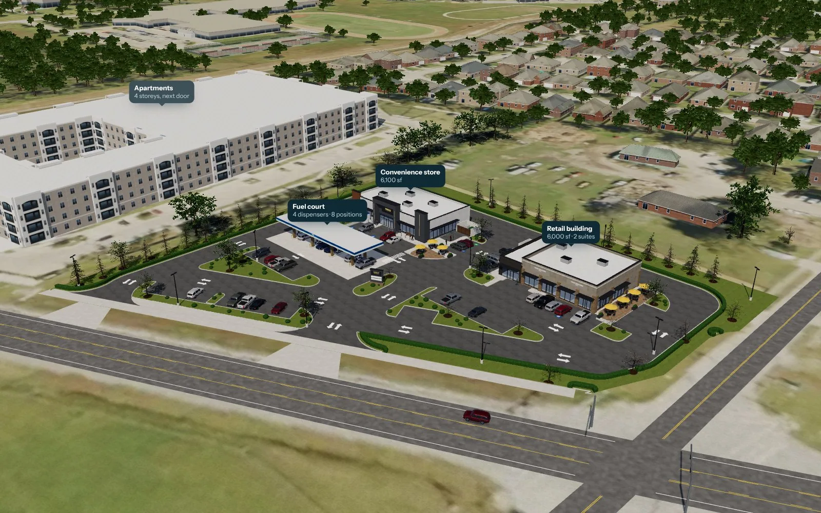
The whole project where it will stand, on 2024 aerial imagery.
Neighbouring houses with roof heights taken from a public elevation survey.
The apartment block next door, so scale is obvious.
Labels on every building with its floor area.
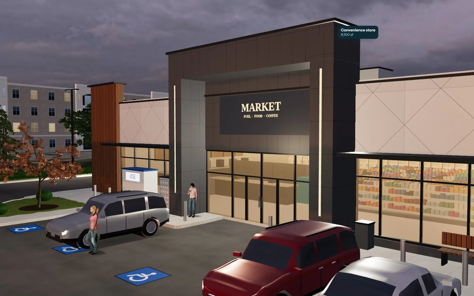
Tour
A guided walk through the stops that sell the project.
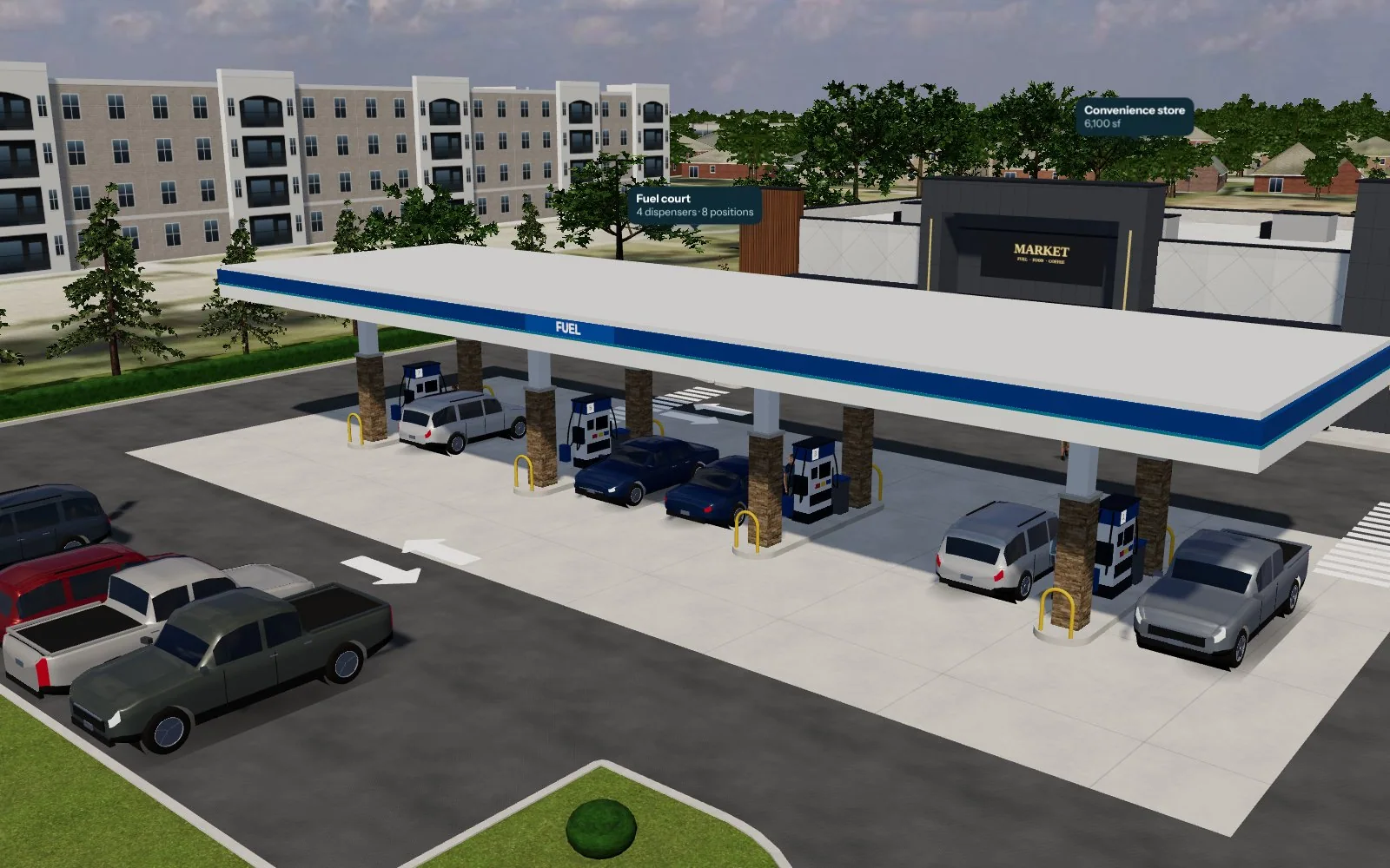
Fuel court, storefront, retail building and patio, one tap each.
Cars and people for scale.
A dusk setting, with the canopy and signs lit.
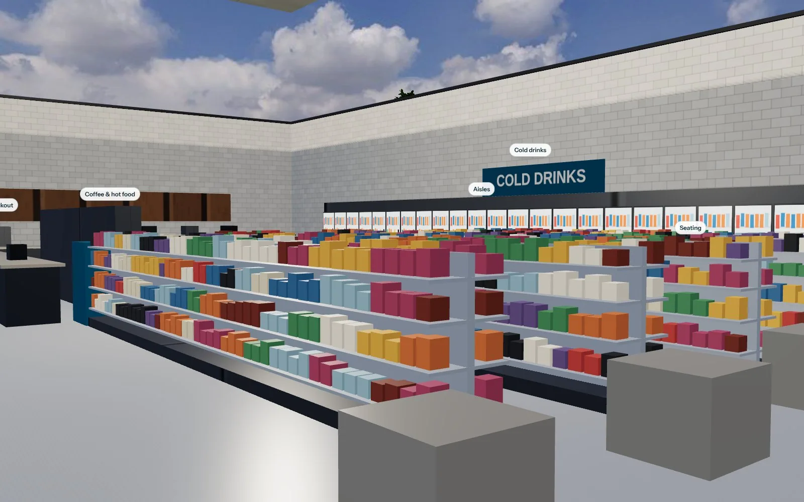
Inside
Step into the main building and look around the floor.
Aisles, checkout, coffee and cold drinks laid out to the floor area.
The roof lifts off for a view from above.
A typical layout, drawn for the model, until you have your own.
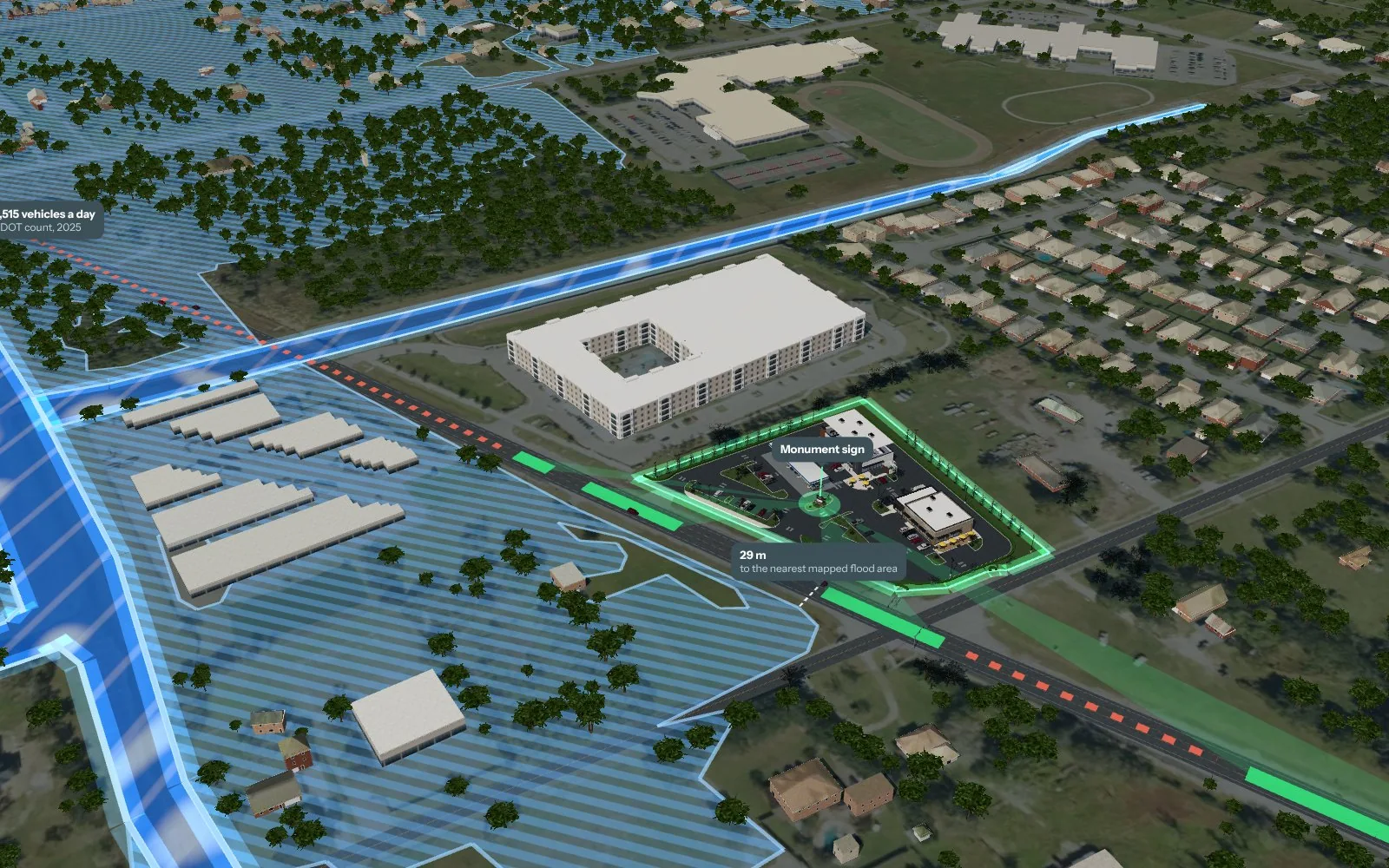
Data
The public record, drawn on the model with its sources.
Mapped flood areas, and how far the lot is from the nearest one.
Traffic counts on the road in front, and homes within a short drive.
Where on the road a driver can first see your sign.
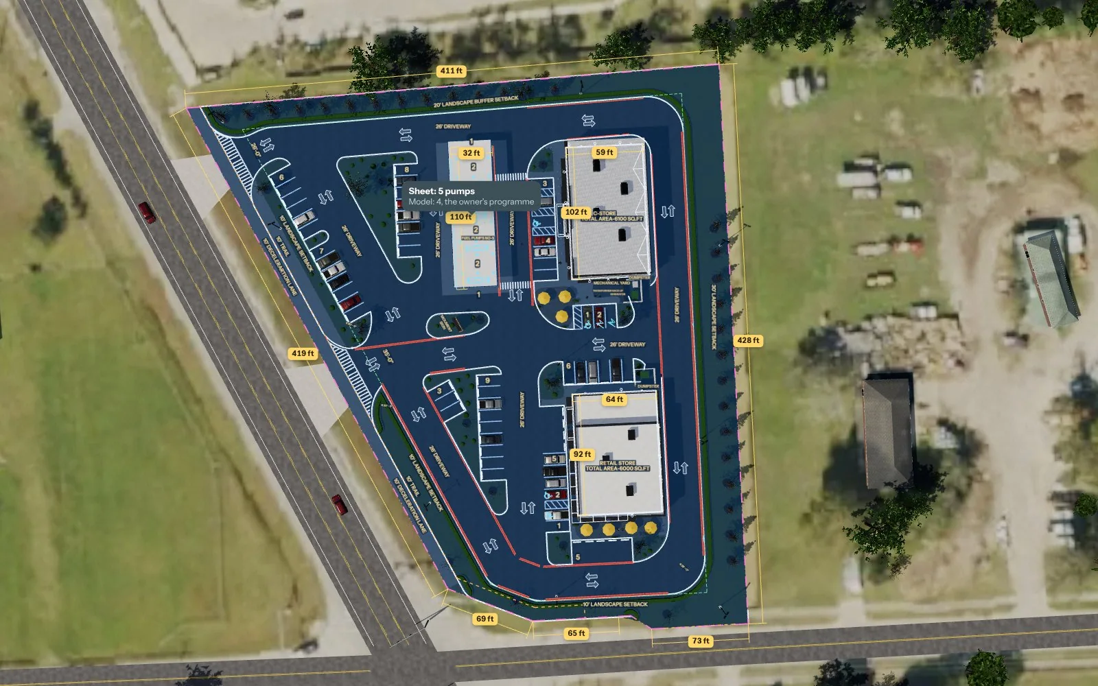
Plan
Your architect’s sheet laid over the model at true scale.
Property line, fire lane, easements and setbacks in colour.
The notes printed on the sheet, where the sheet has them.
Building and lot sizes measured from the drawing, in feet.
More than a picture
What the model told this owner before anyone asked.
FROM THE PUBLIC RECORD
vehicles a day pass the site on FM 270
15,515
vehicles a day pass the site on FM 270
TxDOT traffic count, 2025
homes are within a five-minute drive
7,155
homes are within a five-minute drive
2020 Census blocks
to the nearest mapped flood area; the lot itself is outside them
29 m
to the nearest mapped flood area; the lot itself is outside them
FEMA flood map
is how far south a driver first sees the monument sign
500 m
is how far south a driver first sees the monument sign
Sight lines tested in the model
POINTS TO SETTLE
Fuel pumps: 5 or 4?
The plan sheet notes five. The owner’s programme says four.
Parking: 74 or 64?
The sheet’s table totals 74 spaces. The programme lists 64 stalls.
Found by comparing the drawing with the brief. Better from us than from the city or the lender.
Example figures from the Anchor & Bay model, as fetched in November 2026. Every figure in a model carries its source.
Essential or Premium
What do you have today?
Start with Essential. Pin the address and lay the site out yourself. It is free to explore, and you can order a Premium model later on the same project.
Start with Essential. Block out your idea in the editor, or type what you want and let the assistant place it. Move to Premium once your architect has drawn the plan.
Go straight to Premium. You already have what the AI needs. Send the sheet and we build the model from it.
Add a row of parking in front of the store
Essential
You build it, in minutes.
Pin the site, place buildings and parking in the editor or ask the assistant, and get a simple 3D model, a plan sheet and a list of quantities.
You need
An address
Ready in
Minutes
Cost
Free to explore. Paid plans add takeoffs and share links.
Premium is available for sites in the United States for now, because it relies on the national aerial and elevation surveys.
The meeting goes better when everyone can see it.
THE LENDER
“What exactly am I financing?”
Send the link with the package instead of a plan nobody outside the trade can read.
THE CITY
“How does it sit next to the houses?”
Walk into the pre-application meeting with the neighbours already in the picture.
THE TENANT
“Can drivers see my sign?”
Show the storefront from the road, and the stretch of road it can be seen from.
YOUR PARTNERS
“Where are we with this?”
One link everyone opens, from the phone, without installing anything.
What it is not
It is not a survey, an engineering drawing or a permit set, and nobody at cntrl.build certifies it. It is a planning model built from your drawings and public records, with every source listed, so the people who do sign things can start from the same picture.